Satellite imagery, tasked from Bangkok
Optical and SAR collection ordered through PHOSPHORUS, the EOS Orbit tasking and delivery platform. Downlinked in Thailand, delivered as analysis-ready data.
0.5 m optical / 0.3 m SAR / GeoTIFF delivery
Request tasking →Tasking to delivery
One request, from area of interest to data
Every order moves through the same pipeline, whether it draws from archive or schedules a new collection.
- 01
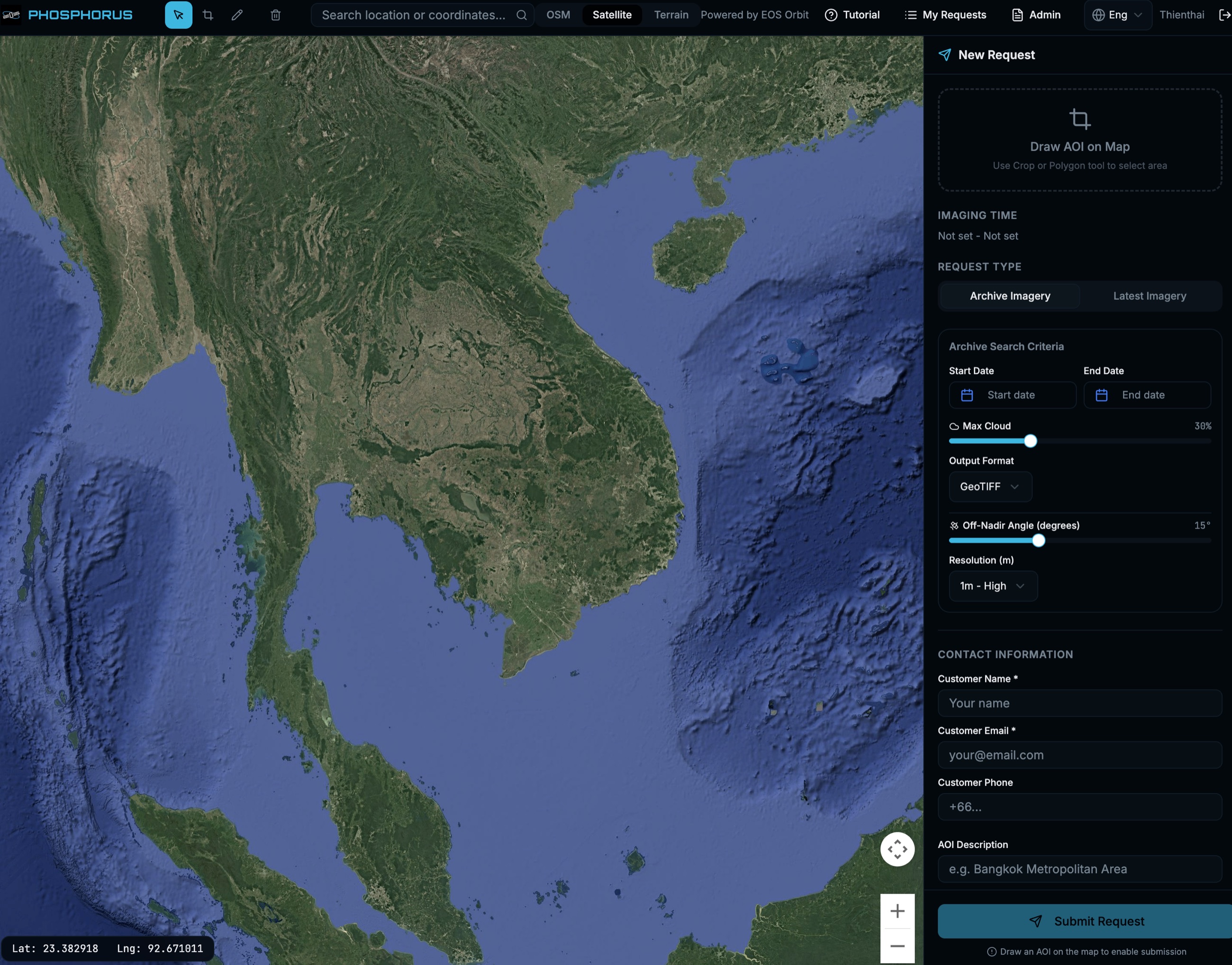
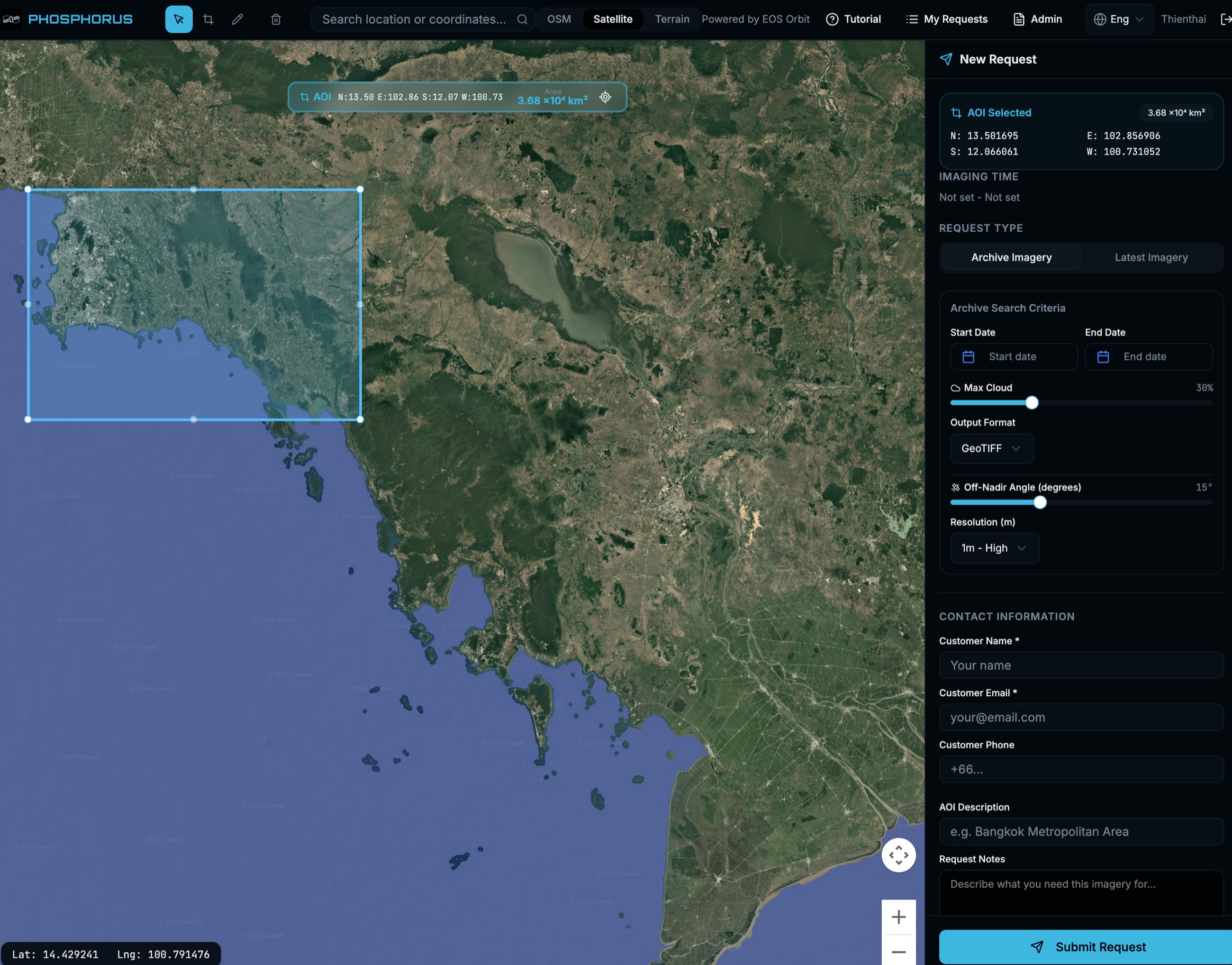
Define
Draw the area of interest on the map. PHOSPHORUS computes corner coordinates and area.
- 02
Specify
Set resolution, cloud ceiling, off-nadir limit, collection window, and output format. Choose archive or new tasking.
- 03
Collect
PHOSPHORUS schedules the request against available optical or SAR capacity.
- 04
Downlink
Data lands at EOS Orbit ground stations in Thailand. EOS Orbit processes it in country.
- 05
Deliver
Analysis-ready GeoTIFF, delivered through PHOSPHORUS with the request record attached.
PHOSPHORUS
Archive search and new tasking in one interface. Draw the area, set the criteria, track the request, receive the data. EOS Orbit built the platform and operates it.
Web / Archive + new tasking / GeoTIFF
Request access →Collection
Optical, SAR, analytics
One platform, multiple sensors. EOS Orbit tasks optical and SAR capacity under its own agreements and delivers through the same pipeline.
Optical
Panchromatic and multispectral collection from 0.5 m to 3.0 m ground resolution. At 0.5 m, individual vehicles resolve and structures track between passes. Archive and new tasking.
0.5 m PAN / archive + tasking
SAR
X-band radar imaging through cloud and darkness. Collection modes from 0.3 m spotlight to 10 m wide-area scan across a 100 km swath.
X-band / 0.3 m spotlight / all-weather
Analytics
Automated object detection and change monitoring over delivered imagery. Counts, classifications, and change flags arrive as structured reports alongside the source data.
Detection / change / monitoring
Sovereignty
Downlinked, processed, and held in Thailand
- Local downlink
- Imagery lands at EOS Orbit ground stations in Nonthaburi and stays under Thai jurisdiction.
- End-to-end encryption
- Encryption covers command, telemetry, and payload data across the full chain.
- Thai control
- EOS Orbit operates the tasking platform, ground segment, and delivery chain from Thailand.
Pathways
Three ways to work
with EOS Orbit
- 01
Order imagery
Archive or new collection, scoped per area of interest. Active today through PHOSPHORUS.
- 02
Hold capacity rights
Reserved collection and priority tasking over defined areas, contracted per term.
- 03
Operate your own satellite
EOS Orbit designs and builds Earth observation satellites and ground segments to customer requirements.
Order imagery
EOS Orbit scopes each request per area of interest, resolution, and revisit. Send the area and the question it needs to answer. The response covers feasibility and a collection plan.
Request tasking →Archive / new tasking / analytics